
3.4 — Peatland degradation
Threats to peatlands
Page 4 / 6
When high land becomes low land
Over centuries, these processes fundamentally changed the relief of the western Netherlands. Before reclamation, peat bogs could rise above the surrounding river and coastal landscapes. But peat subsided much more strongly after drainage than adjacent mineral soils.
The result is known as relief inversion or an inversion landscape: areas that were once relatively high became relatively low.
The following geological cross-section of the Dutch coastal plain shows this particularly well by comparing the situation before human reclamation with the landscape after drainage, compaction and oxidation.
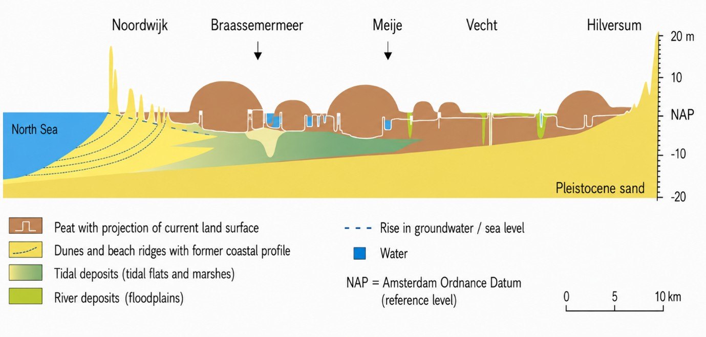
© Cross-section from the North Sea coast to the Gooi region indicating several cities from the coast to the inland area. Oligotrophic peat domes (bogs) were cut away for peat extraction, while fens along rivers subsided after drainage. What was once high became low. Landschappen van Nederland.
Before people began to reclaim the peatlands, raised bogs (oligotrophic peat domes) stood above the surrounding landscape. Fen areas along rivers were also higher than sea level.
But centuries of human land use changed this completely. Oligotrophic raised bogs were cut away to extract peat for fuel (turf) from the Middle Ages onwards, sometimes down to the mineral subsoil. At the same time, fens along rivers compacted and the peat oxidized after drainage. As a result, a large part of the original peat has disappeared.
The landscape that was once high and relatively wet is now low and dependent on drainage. This is what we call relief inversion: high land became low land.
This reclamation history can still be observed in the Netherlands today. While the drained peat surface continued to subside, water levels in some waterways remained relatively high. As a result, waterways can now lie above the surrounding land.
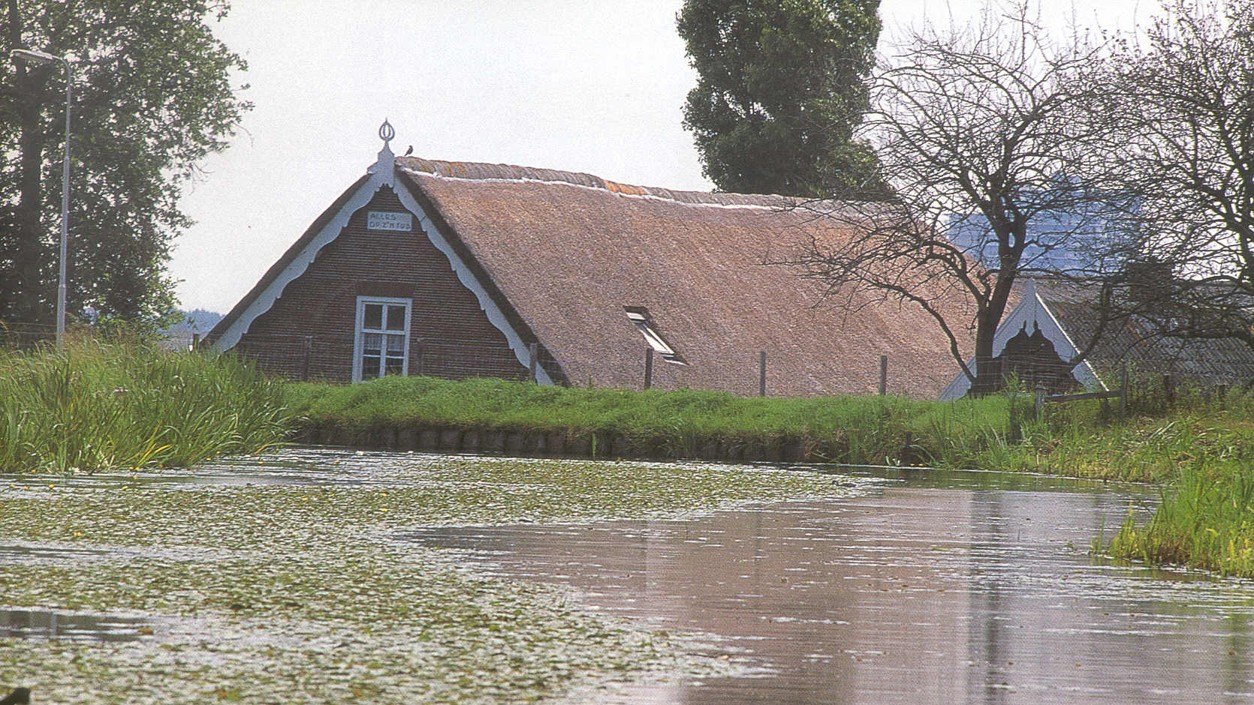
© Water above the land. The waterway has remained close to its medieval level, while the house stands on drained peat that has subsided by several metres. Imagine looking out at the waterway from your upstairs bedroom! Quite normal for the Dutch, perhaps, but an unsettling sight for many others. Photo archive of the Soil Geography and Landscape group, WUR.
Watch this very interesting video “Verhaal van Woerden – Veranderend Landschap” about the history of the peat meadow landscape around the old city of Woerden. The video was produced by “Stadsmuseum Woerden”, is approximately 8 minutes long, and tells and shows the fascinating story about the transformation of the Dutch peat meadow landscape. Make sure to activate the English subtitles on Youtube if you need them.
What began as an intervention to make a wet landscape suitable for agriculture initiated a process that would continue for centuries. As the peat surface subsided, increasingly active water management was needed to keep the land usable. Further drainage, in turn, caused further peat loss and subsidence.
Peat oxidation and subsidence are not merely historical processes. Long-term measurements at Zegveld (NL, peat meadow area), for example, found approximately 24 cm of subsidence over 50 years under a relatively high ditch-water level and 31 cm over 53 years under a lower ditch-water level. The process that began with medieval reclamation has not ended.